|
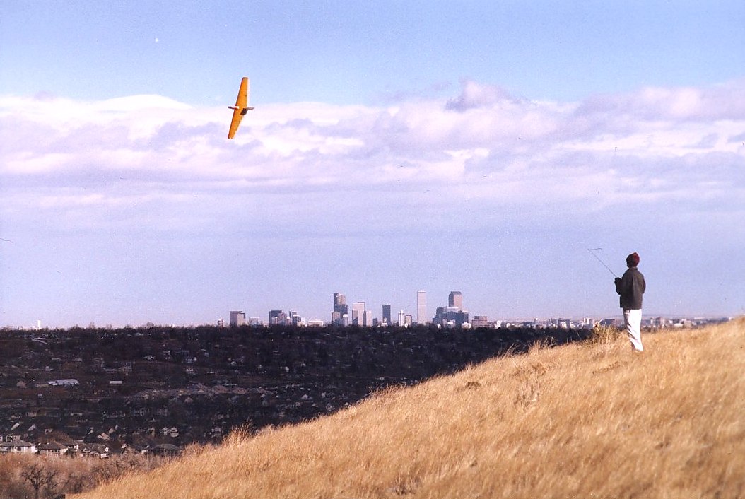
NCAR south face.
NCAR topo
Wow.. If the wind is blowing up from the southwest you can drive (Table Mesa Blvd to NCAR)
right to the top of a slope with 400 ft verticals that becomes very steep at the top.
Visibility is a bit tricky side to side because there are trees along the lip but when the
wind's cranking up this slope it rocks. Airspace can be a bit busy sometimes as this *is*
the place to fly near Boulder if the wind is right. It also catches big thermal and
upslope from the housing developments and the plains below. Advantages: ease of access,
big slope. Can find out the wind and weather at this slope here:
NCAR
Mesa weather
I did catch sparks off my transmitter one day up here, so pay attention to the weather and
come down if the sky gets dark.
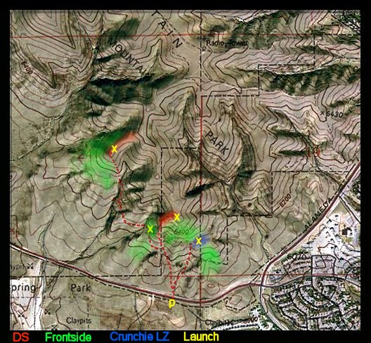
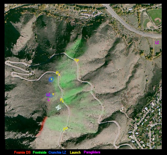
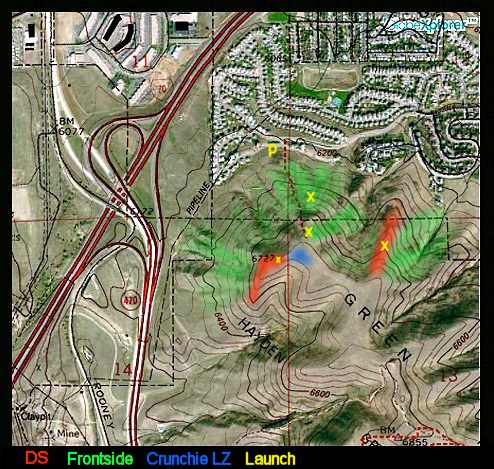
Lookout Mountain (actually Mt. Zion)
Check out this newer site map for Zion.
(Click on the image to see a larger/clearer version with more context.)
Mt.
Zion Topo (the squiggly road where it says Mt. Zion on the map)
Ok, first the warning. This is a serious place to fly.
Don't come up here and screw around. Why? Because
this is where the paragliders and hang gliders fly from. They actually happen
to like seeing a high performance glider out roaming around the sky showing them where the
thermals are. Paragliders don't fly very fast so most R/C gliders will easily
outfly them. BUT, they'll only put up with us as long as we fly safely
and considerately, and I consider it my duty to show them where the lift is from time to
time, even if I'm into zipping around near the slope. The first person
you hit a PG/HG in the air, or the first car you hit on the road (we fly from the road usually),
could be the last ever. DON'T get us kicked out of this airspace.
We also generally discourage the use of electrics up here
because they're not allowed on Jeffco Open Space, and there's a risk of
fire. I had real serious doubts about putting the info up
here about this site, but I can't in good conscience leave it
out. Also, if flying on 72Mhz be sure to go up
to the top most launch point to check frequencies before you fly from
anywhere up here.
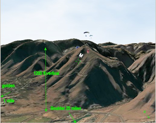
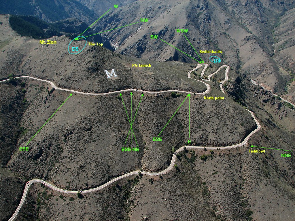
Ok, that out of the way. This is a great place to fly. To
get there, turn onto Lariat Loop Rd. just west of Golden and keep going
up until you reach the big "M" (for School of Mines) on the NE corner
of the mountain (see the topo map). Turn around at the M, and
drive back to the next pull-out at the North East corner and park
there. On the way up, you'll go through 3 switchbacks and
about 2 blind right turns after that, there's a pulloff on the west
side of the road. Park diagonally (uses less space and you can
turn around when you leave).
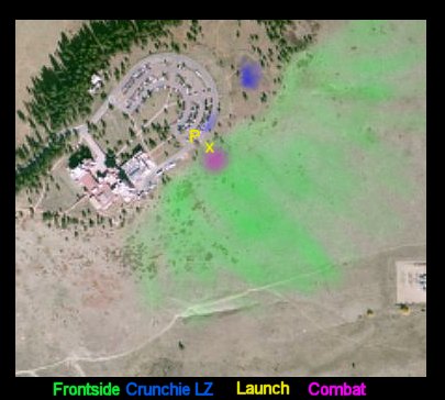
It's only partly a slope site, and to a large degree a thermal
site. Thermals seem to form from everywhere East of
Golden, get triggered by something.. maybe the highway below, and then
there's massive lift up the 1240 foot face of the hill from the highway
to the big "M" which is a few feet away from the paraglider launch
point. In a steady 5mph ENE wind you can fly a brick off
this hill. When the thermals come through (often
continuously) you can easily disappear a
glider. It's a lot of fun flying with the
paragliders, but also a lot of work. My
advice. NEVER intersect them visually. We call it
the "Blue Sky Rule" Can fly above them, or below them or turn
before you reach them, but don't try to fly in front of, or behind
them, unless your glider is 50 feet away and they're 500 feet.
When you're flying from the road, be aware that
they're launching right over your head so keep looking up.
E and ENE are the best wind directions, but you can fly ESE and SE if
you go around the corner in the road to the south a 100
yards. NE and NNE can be flown as well, but
generally it's better to go back down the road a bit. Go
back down through the 3 switchbacks and 2 right turns past and there's
a pullout on the east side of the road. From that corner
it's a VERY steep dropoff (Don't crash down there), but the
lift can be near vertical. Even the
cliffs, a little to the west have been flown, but they truly are
vertical.
Landings are primarily in the grass on the east or north faces (if the
lift is to the east, land to the north. If the lift is to the
north, land on the east side). Plenty of people fly their
crunchies here, but
you must be patient with the landing.
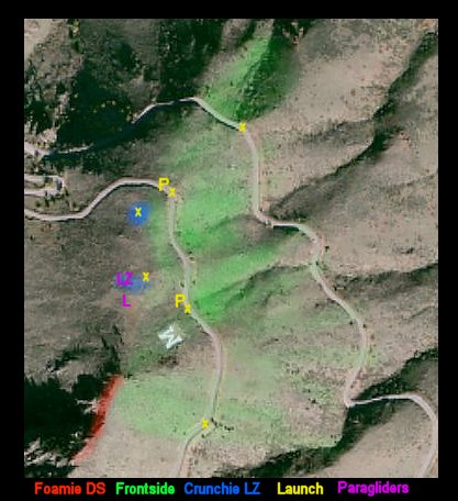
(09/09/03 update) Mt. Zion West. In a WSW wind the
backside of Mt. Zion can be flown. On the way up you go through 3 180 degree
switchbacks. At the middle of the 3rd, is a 900+ foot drop down to Clear Creek.
Avoid due west winds because of rotors off the mountain directly to the
west. But Clear Creek Canyon runs WSW so if the wind is ripping (and really 25-30mph
is best because then the lift outweighs any possible turbulence) this place is just pure
vertical lift. Pretty much foamie territory. Best LZ is to land on
the hillside up and to the south of the road where the hill starts to flatten out.
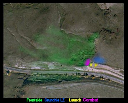
Highway 93 West - On the way to Boulder on highway 93, a
couple miles south of town, there's big hill that decends down into the valley that
Boulder sits in. Near the top of that hill is a pullout on the west side facing
Eldorado Canyon. There's a little slope there, that with a west wind is fairly
punchy and can be a great place to stop and fly a little quicky. Here's a page with some photos and videos from the site.
Also.. there's a large ridge that juts out just in front of
Eldorado Canyon about a half mile west of this site. I've been told it's
probably the premiere DS site in Colorado. I haven't flown there yet. To
get to it, park on the east side of the highway at the top of the hill, jump the fence and
walk out there (it's Boulder open space land). From that ridge you can
fly West or NE winds.
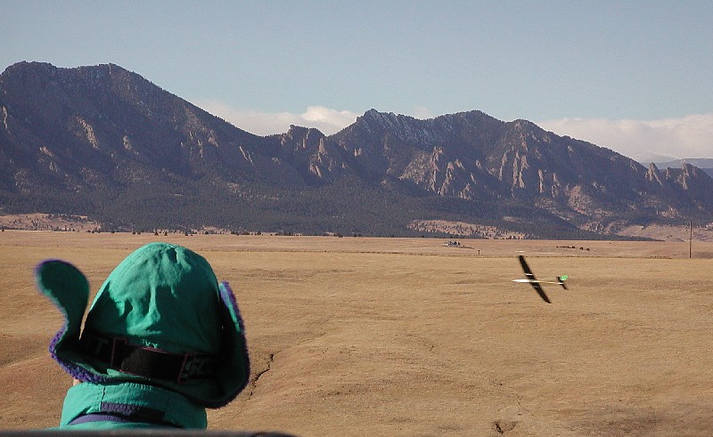
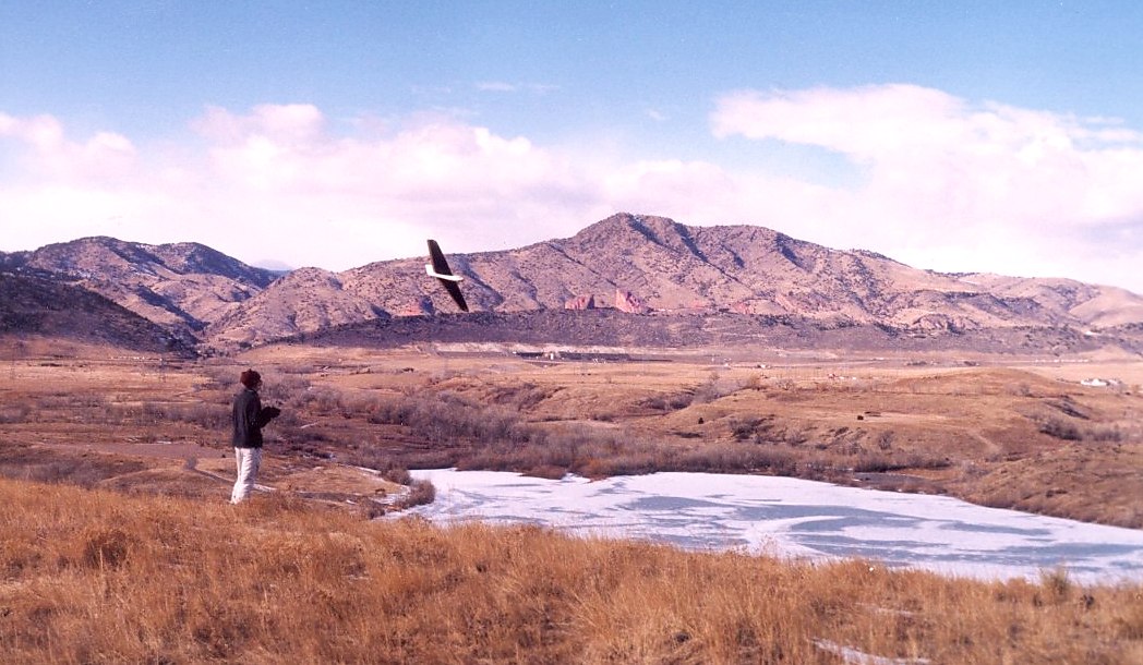
Loveland Pass - I flew this a while back and just now am
finally getting to an update. Take highway 6 from near the entrance to
Eisenhower Tunnel up to the top of the pass. Every time I've been there,
the wind has either been blowing from the W, WNE, NW hard or not blowing at all.
We usually hike up a few hundred feet and fly east of the highway.
Dress warm, it *will* be cold here even if it's hot in Denver.
Bring lots of water. Great way to get sick is to get dehydrated after
hiking up a few hundred feet, above 12,000 feet. Here's some photos from one of our
trips up there. In the first photo we're looking across to the slope we
usually fly on (about 1/4 of the way up.) The lift can be just
absolutely insane. The landings can be tricky so bring some foamies and then decide
if you want to try putting a crunchie down on top (it's possible).
So there you have it. All the places I've
flown. We've been talking about making a trip to the top of Mt. Evans (which has highest paved
road in US). With nearly 50% less oxygen than at sea level, even Zagi flies VERY
very fast up there. A fast foamie like my Bluto should be pretty
amazing.
|
